New Digital World Atlas Provides Dynamic, Sharable Maps
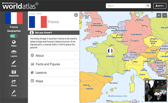
A sample map from Rand McNally World Atlas |
At the International Society for Technology in Education Conference and Expo this week in Atlanta, Rand McNally launched a digital world atlas aimed at the education market. The online service, dubbed Rand McNally World Atlas, provides thousands of dynamic maps with data overlays, cross-curricular content and standards support.
The atlas tools comprise social studies, history and geography content as well as reading programs and writing lesson plans. Teachers can access historical maps, boundaries and demographics on present-day maps; create custom maps; annotate maps; and share maps with students, teachers and other classes. Any map can be printed out either fully populated or in outline form.
Other features include:
- Thematic maps and data layers, including population density, climate, historical boundaries and natural hazards;
- Lesson plans and resources for building presentations;
- World event articles for reading and writing connections;
- Individual student accounts for customizing and saving maps; and
- Access from anywhere with an Internet connection.
World Atlas is aligned with state and Common Core standards and is available via annual subscription.
For more information, visit the Rand McNally site.
About the Author
Rhea Kelly is editor in chief for Campus Technology, THE Journal, and Spaces4Learning. She can be reached at [email protected].